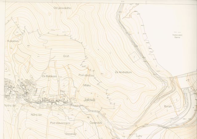
State maps derived
State Maps Derived are seamless State map series published at a scale of 1:5 000.
The 1st edition of the map series was created between 1952 and 1958 by derivation from all suitable available documents and therefore it was named the State Map Derived 1:5 000 (ŠMO5). After a certain generalization, the topography was obtained from available cadastral maps or land consolidation maps and the elevation from topographic maps of various scales and in some cases the contours from the 3rd military mapping had to be used. Over time, in other editions the elevation was refined by adopting the elevation from military topographic maps, at first from a scale of 1:25 000 and later from a scale of 1:10 000. The 1st edition from the entire territory of the state was completed in 1958 and more than 25 000 map sheets were created. After the 2nd edition, which was considerably refined especially in the elevation part, further maintenance of this successful and unique work took place in the so-called reissue.
The other editions of ŠMO5 used mainly the Technic-Economical Maps (THM), current aerial photographs, various purpose maps often made on a fairly large area and topographic maps of 1:5 000 and 1:10 000 scales processed in the S-42 coordinate system. The ŠMO5 are printed in two colours, topography in grey and elevation - contours and spot heights in brown. The ŠMO5 map series ceased to be published in the 1990s.
The map series are made in JTSK rectangular coordinate system in Křovák's projection. The layout and labelling of map sheets is based on maps in 1:50 000 scale. The frame of the map sheet at 1:50 000 scale was labelled after the most important settlement. The layout can be downloaded in the Download section.
The ŠMO5 Raster product is represented by scanned and georeferenced maps of the ŠMO5 collection in raster form with a resolution of 400DPI. THM5 with elevation in raster form are scanned and georeferenced maps of the THM5 collection that contain the elevation layer. Their content complements the editions of the ŠMO5 collection.
The ŠMO5 Raster and THM5 with elevation products are available for viewing via the MAPKA application within the Archive theme. The ŠMO5 Raster from the ŠMO5 collection - other editions can be downloaded using the Data export function in the TIFF + TFW raster format in the S-JTSK (JTSK) coordinate system (EPSG code: 5514). The download procedure is described in the Help. The latest editions from this collection are available for viewing and downloading. Their originals are stored in analogue form in the Central Archive of Geodesy and Cartography. For the relevant nomenclature is the basic information also given on the availability of other older editions from this collection - on the availability of the ŠMO5 – 1st edition, or the THM 1:5 000 collections with elevation (not available raster files can be requested via the Customer Centre). The map sheet layouts of the ŠMO5 collection of the 1st and other editions with all basic information can be downloaded here.
The ŠMO5 Raster Products are subject to the Terms and Conditions of Provision and Use
Instructions for connecting georeferenced rasters to Bentley MicroStation V8i application (Slovak only) can be downloaded here. Instructions for connecting georeferenced rasters to Kokeš application (Slovak only) can be downloaded here.
Updated: 14.06.2024

