Order
Due to the large volume of data (several TB), the Classified Point Clouds are still provided in an offline mode on a lot-by-lot basis through the customer centres - Bratislava (Chlumeckého 4) and Prešov (Suvorovova 2).
If you are interested in obtaining Classified Point Cloud from the 2nd cycle, please complete the order form and deliver it to the contact address here:
Table of approximate 2nd cycle ALS products file sizes is available for download here.
If you are interested in obtaining Classified Point Cloud from the 1st cycle, please complete the order form and deliver it to the contact address here:
Table of approximate 1st cycle ALS products file sizes is available for download here.
Products of Airborne Laser Scanning DTM 6.0 a DSM 2.0 from the 2nd project cycle in TIFF raster format with a spatial resolution of 0,5 m are freely available for online download through the cloud according to individual finished locations (lots).
Products of Airborne Laser Scanning DTM 5.0 a DSM 1.0 from the 1st project cycle in TIFF raster format with a spatial resolution of 1,0 m are freely available for online download through the cloud from whole area of Slovakia.
Smaller volume data (sections) (DTM 5.0 and DSM 1.0 to 400 km2, Classified Point Cloud to 2 km2) can be downloaded via the MAPKA application, more information here.
More information about the provision of ALS products from the 1st and 2nd cycle is here.
When creating own work and publishing it, the users are obliged to indicate the source of ALS Products as follows: "ÚGKK SR". The provided Products are subject to the Terms and Conditions of the Provision and Use of Airborne Laser Scanning Products.
ZBGIS® data are provided via portal Product and services (Slovak only).
Data selection procedure:
1. At first is necessary to register and create acount by clicking on button Registrovať sa.
2. Data selection is possible in the left part Výber produktu, where it is necessary to select items: Digitálne údaje -> Referenčné priestorové údaje -> ZBGIS®údaje and then select a data category (Slovak only)).
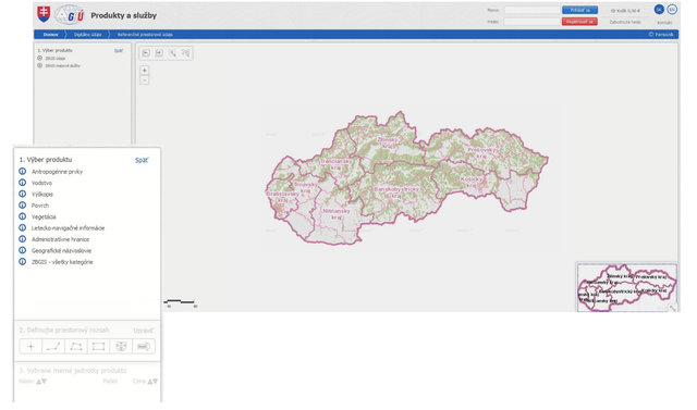
3. Defining the spatial extent based on units of measure (UM). UM can be selected by point, line, polygon, rectangle, actual map view or by name of UM or administrative unit and can be removed or re-added as needed. To order, it is necessary to click on button Kúpiť v základnej cene, select data format and coordinate reference system and then click on buton Vytvoriť objednávku (Create order).
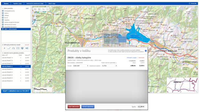
More information on how to choose and order data can be found here (Slovak only).
The UM for ZBGIS® products was determined as follows:
For the UM for the sale of ZBGIS data and services was determined an extent of the map sheet for a scale of 1: 5000, which represents an area of 2.5 x 2 km (10199 UM in the territory of the Slovak Republic). A price was determined for each UM and data category, which takes into account the density and actuality of the data on it.
Overviews of the UM for ZBGIS® products provided on the territory of the Slovak Republic can be found in the table:
ZBGIS - Antropogénne prvky |
ZBGIS - Vodstvo |
ZBGIS - Výškopis |
ZBGIS - Povrch |
ZBGIS - Vegetácia |
ZBGIS - Letecko-navigačné informácie |
ZBGIS - všetky kategórie |
Sample of ZBGIS® data is available here.
Updated: 13.11.2024