ZBGIS® Categories
The scope of individual feature classes is declared by the content defined by valid ZBGIS® Feature Catalogue (KTO ZBGIS®), which has been standardized on the basis of the international DIGEST standard using FACC coding of individual features. Each feature class has its own FACC code, based on which the feature belongs to the appropriate category. DIGEST specifies a clear database structure and coding.
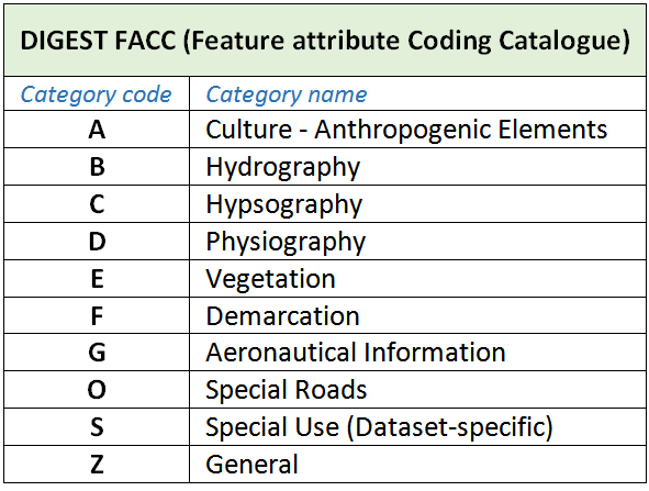
Category - determines the characteristics of features belonging to it. ZBGIS® as a whole is composed of 10 selected categories (Table 1), where the content (classification) identifies individual topographic features according to the theme. Category code used in ZBGIS® is determined by the first letter of FACC feature class code.

Tab. 1: List of feature categories by DIGEST
