ZBGIS® Raster
A new product - ZBGIS® Raster is available to public since 2018. It represents data export from ZBGIS® information system databases in raster form in TIFF format in S-JTSK(JTSK03) coordinate system (georeferenced TIF + TFW files) for 1: 5 000 - 1: 50 000 scales. A cartographic representation is assigned to vector features which is then used for displaying data in different scales. A detailed description of the symbolism and its rules for individual scales is given in the ZBGIS® Display Catalogue. Map sheet layouts were designed according to a new cartographic model for the 1: 10 000 scale. Other scales were created by deriving from this scale. Layouts can be downloaded in the Download section. Downloading ZBGIS® rasters is possible via the MAPKA application, the download procedure is desribed in the Help. ZBGIS® Raster shall be subject to the Terms and conditions for the provision and use.
Instructions for connecting georeferenced rasters to application Bentley MicroStation V8i can be downloaded here (Slovak only). Instructions for connecting georeferenced rasters to application Kokeš can be downloaded here (Slovak only).
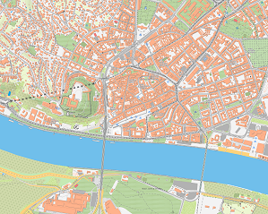
ZBGIS Raster 1:5 000
It continuously covers the territory of the Slovak Republic at the 1: 5 000 scale and the number of rasters is 10 201. The map contains data with the degree of detail and abstraction according to the ZBGIS® Feature Catalogue (KTO ZBGIS®). The displayed data is from these categories: Anthropogenic Elements, Hydrography, Hypsography, Physiography, Vegetation, Demarcation, Geographical Names (non-standardized and standardized names).
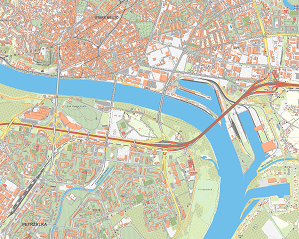
ZBGIS Raster 1:10 000
It continuously covers the territory of the Slovak Republic at the 1: 10 000 scale and the number of rasters is 2 635. The map contains data with the degree of detail and abstraction according to the ZBGIS® Feature Catalogue (KTO ZBGIS®). The displayed data is from these categories: Anthropogenic Elements, Hydrography, Hypsography, Physiography, Vegetation, Demarcation, Geographical Names (reduced content of non-standardized and standardized names).
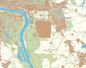
ZBGIS Raster 1:25 000
It continuously covers the territory of the Slovak Republic at the 1: 25 000 scale and the number of rasters is 463. The map contains reduced data with the degree of detail and abstraction according to the ZBGIS® Feature Catalogue (KTO ZBGIS®). The displayed data is from these categories: Anthropogenic Elements, Hydrography, Hypsography, Physiography, Vegetation, Demarcation, Geographical Names (reduced content of non-standardized and standardized names) in combination with the generalized data of settlements.
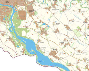
ZBGIS Raster 1:50 000
It continuously covers the territory of the Slovak Republic at the 1: 50 000 scale and the number of rasters is 132. The map contains generalized data at the 1: 50 000 scale.
| ZBGIS rasters for download | |
|---|---|
| ZBGIS Raster 1:5000 | ZIP (93 GB) |
| ZBGIS Raster 1:10 000 | ZIP (35 GB) |
| ZBGIS Raster 1:25 000 | ZIP (7 GB) |
| ZBGIS Raster 1:50 000 | ZIP (2 GB) |
ZBGIS Raster data shall be subject to the Terms and conditions of provision and use of Orthtophotomosaic.
| Layouts of ZBGIS Raster map sheets | Format | ||||||
|---|---|---|---|---|---|---|---|
| 1 : 5 000 | Esri SHP | Esri GDB | GeoPackage | DGN | DXF | ||
| 1 : 10 000 | Esri SHP | Esri GDB | GeoPackage | DGN | DXF | ||
| 1 : 25 000 | Esri SHP | Esri GDB | GeoPackage | DGN | DXF | ||
| 1 : 50 000 | Esri SHP | Esri GDB | GeoPackage | DGN | DXF | ||
| License terms for map sheets layout | |
| Author | GKÚ Bratislava |
| License | CC-BY 4.0  |
Updated: 14.06.2024


